
Severe Tropical Storm #OpongPH (Bualoi)
Issued: 8:00 PM, 25 Sept 2025 | Next update: 11:00 PM
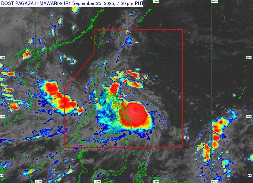
OpongPH moves closer to Eastern Visayas
- Location (7 PM): 150 km east of Borongan City, Eastern Samar (11.6°N, 126.8°E)
- Intensity: Max sustained winds 110 km/h, gusts up to 135 km/h, central pressure 980 hPa
- Movement: West northwestward at 20 km/h
- Wind Radius: Strong to storm-force winds extend up to 460 km from the center
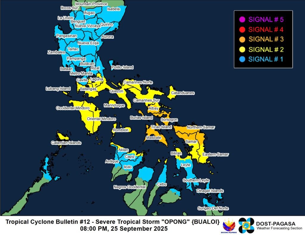
⚠️ Tropical Cyclone Wind Signals (TCWS)
- Signal No. 3 (Storm-force winds, 89–117 km/h, 18 hrs lead time):**
Sorsogon, southern Albay, Masbate, Northern Samar, northern Eastern Samar, northern Samar - Signal No. 2 (Gale-force winds, 62–88 km/h, 24 hrs lead time):
Laguna, Batangas, Quezon (southern towns), Camarines Norte & Sur, rest of Albay, Catanduanes, Marinduque, Mindoro, Romblon, Calamian Islands, Biliran, parts of Leyte, northern Cebu (incl. Bantayan), northern Aklan, northern Capiz, northern Iloilo, Caluya Islands - Signal No. 1 (Strong winds, 39–61 km/h, 36 hrs lead time):**
Metro Manila, Rizal, Cavite, Bulacan, Pampanga, Tarlac, Zambales, Bataan, Nueva Ecija, Aurora, Isabela (south/central), Quirino, Nueva Vizcaya, Benguet, Ifugao, La Union, Pangasinan, northern Palawan (incl. Cuyo Islands), Leyte, Southern Leyte, northern Bohol, rest of Cebu (incl. Camotes), northern Negros Occidental, central Iloilo, Antique (north), Surigao del Norte & Dinagat Islands
Other Hazards
- Rainfall: Heavy rains from Opong and the Southwest Monsoon. (See Weather Advisory No. 25)
- Winds: Strongest in Signal No. 3 areas; gale-force winds possible under Signal No. 2; strong winds under Signal No. 1.
- Sea Conditions: Gale Warning in effect; seas up to 11 m in Catanduanes, Albay, Sorsogon, Northern & Eastern Samar; very rough seas elsewhere. Travel by sea is extremely risky.
- Storm Surge: High risk of life-threatening surges >3 m in low-lying coastal areas of Zambales, Bataan, Metro Manila, CALABARZON, Mindoro, Romblon, Palawan, Bicol, Northern Samar, Eastern Samar, Leyte, Cebu, Aklan, Capiz, Antique, Dinagat & Siargao Islands. (See Storm Surge Warning No. 6)
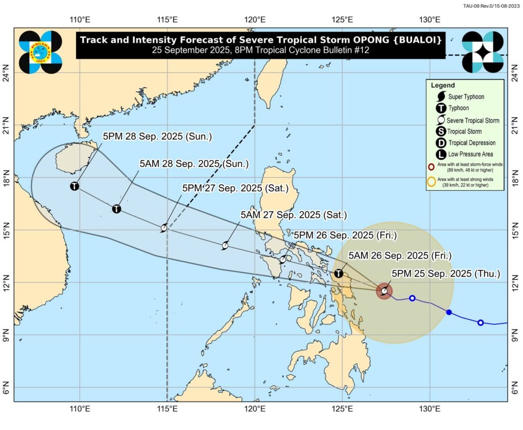
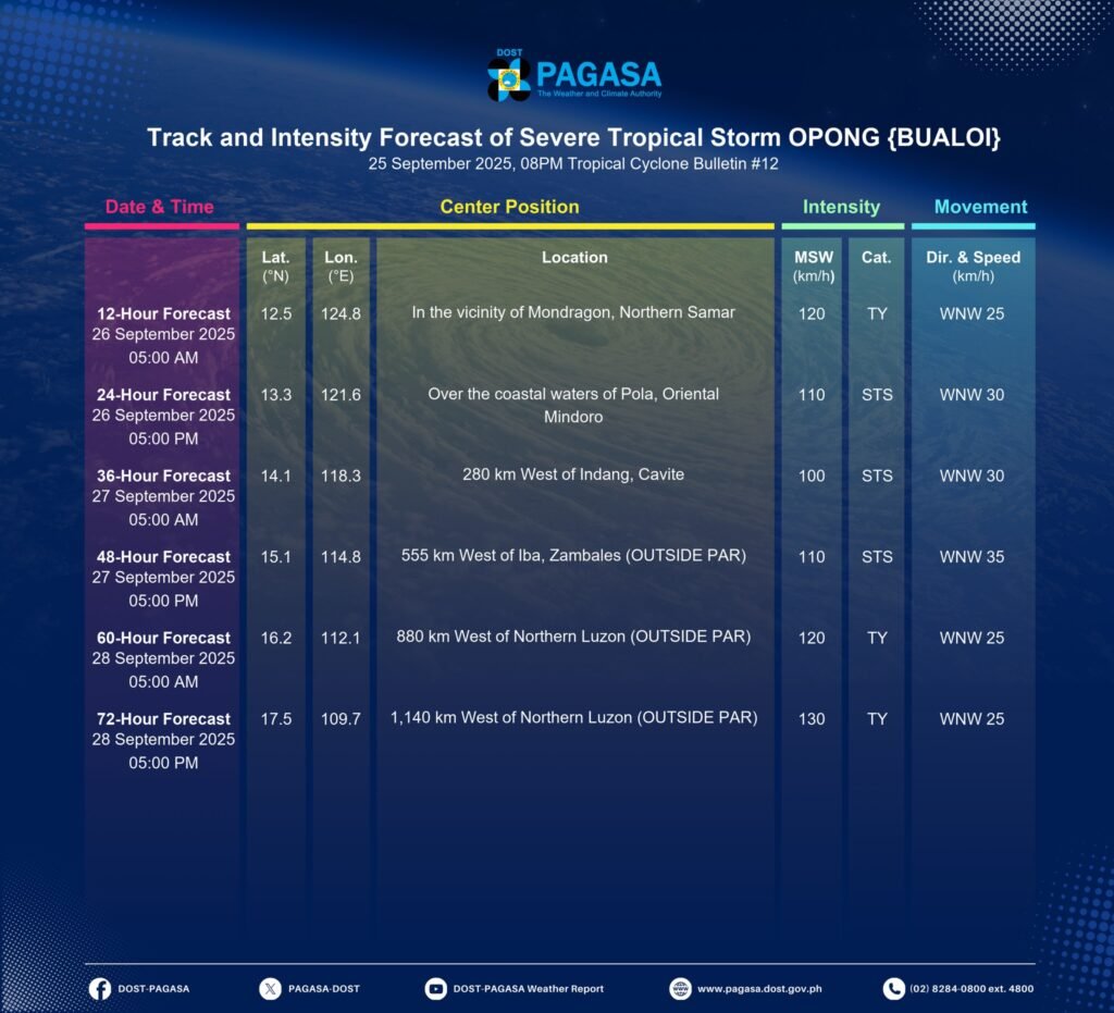
📍 Forecast Track
- Landfall likely over Northern Samar or northern Eastern Samar early Sept 26, then another landfall in Sorsogon later that morning.
- Will cross Bicol, southern CALABARZON, northern MIMAROPA**, then emerge over the West Philippine Sea by early Sept 27.
- May strengthen into a typhoon before landfall; weakening expected inland but re-intensification possible over sea.
👉 Residents in affected areas should prepare, follow local authorities, and evacuate if advised. Stay updated through PAGASA bulletins.
🔗 More info: tinyurl.com/TCB-OpongPH