



𝐈𝐬𝐬𝐮𝐞𝐝 𝐛𝐲 𝐏𝐀𝐆𝐀𝐒𝐀 𝐚𝐭 𝟓:𝟎𝟎 𝐏𝐌, 𝐎𝐜𝐭𝐨𝐛𝐞𝐫 𝟐, 𝟐𝟎𝟐𝟓
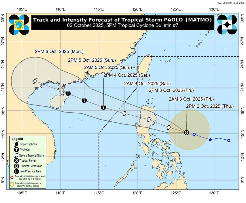
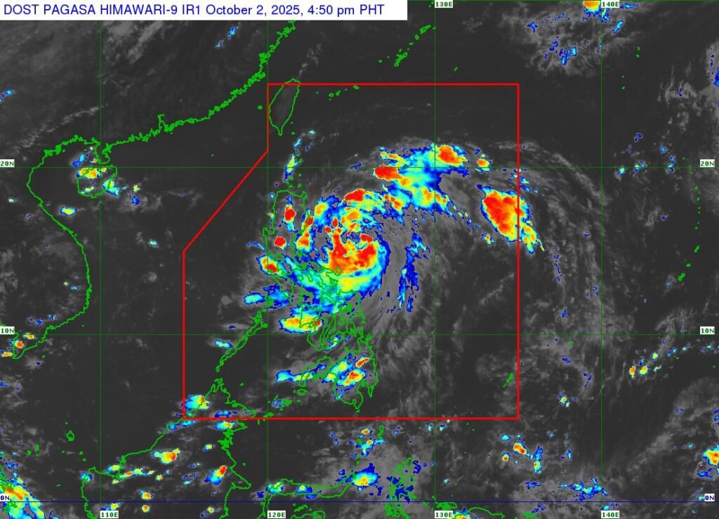
Tropical Storm Paolo (international name: Matmo) has slightly intensified while moving west-northwestward over the Philippine Sea. As of 4:00 PM, its center was located 480 km east of Infanta, Quezon or 480 km east of Baler, Aurora with maximum sustained winds of 85 km/h, gusts of up to 105 km/h, and a central pressure of 996 hPa. It is moving at 15 km/h.
Strong to gale-force winds extend outward up to 350 km from the center.
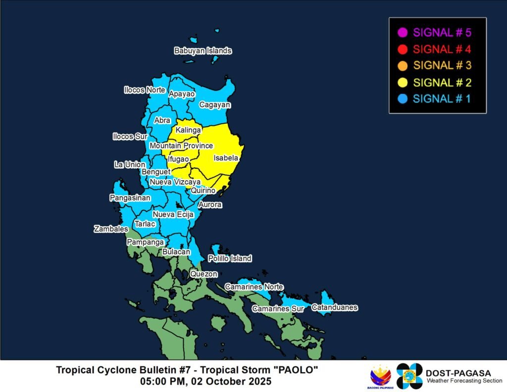
𝐓𝐫𝐨𝐩𝐢𝐜𝐚𝐥 𝐂𝐲𝐜𝐥𝐨𝐧𝐞 𝐖𝐢𝐧𝐝 𝐒𝐢𝐠𝐧𝐚𝐥𝐬 𝐢𝐧 𝐄𝐟𝐟𝐞𝐜𝐭
𝐒𝐢𝐠𝐧𝐚𝐥 𝐍𝐨. 𝟐
- Wind threat: Gale-force winds (62–88 km/h)
*Impacts: Minor to moderate threat to life and property - Isabela
- Northern Quirino (Maddela, Aglipay, Cabarroguis, Saguday, Diffun)
- Northern Nueva Vizcaya (Diadi, Bagabag, Quezon, Solano, Villaverde, Ambaguio, Bayombong, Kasibu)
- Kalinga
- Mountain Province
- Ifugao
- Northern Aurora (Dilasag, Casiguran, Dinalungan)
𝐒𝐢𝐠𝐧𝐚𝐥 𝐍𝐨. 𝟏
Wind threat: Strong winds (39–61 km/h)
Impacts: Minimal to minor threat to life and property
- Cagayan
- Rest of Quirino
- Rest of Nueva Vizcaya
- Apayao, Abra, Benguet
- Ilocos Norte, Ilocos Sur, La Union, Pangasinan
- Northern Zambales (Palauig, Masinloc, Candelaria, Sta. Cruz)
- Tarlac, Nueva Ecija
- Rest of Aurora
- Northern Bulacan (Doña Remedios Trinidad, San Miguel, San Ildefonso, Norzagaray, San Rafael)
- Northern Pampanga (Magalang, Arayat, Candaba, Mabalacat City)
- Northern Quezon (General Nakar, Infanta) including Polillo Islands
- Camarines Norte
- Northern Camarines Sur (Siruma, Tinambac, Lagonoy, Garchitorena, Caramoan, Goa, San Jose, Presentacion)
- Catanduanes
Other Hazards
*Heavy Rainfall: Refer to Weather Advisory No. 5 (5:00 PM). Widespread rains expected in Northern and Central Luzon.
- Severe Winds: Minor to moderate impacts in Signal No. 2 areas; minimal to minor in Signal No. 1 areas. PAGASA notes Signal No. 3 is likely, and Signal No. 4 is possible if Paolo strengthens into a typhoon before landfall.
- Storm Surge: 1.0–3.0 meters possible within 36 hours in coastal areas of Ilocos Norte, Cagayan, Isabela, Aurora, Quezon, Camarines Norte, Camarines Sur, and Catanduanes.
- Coastal Waters: Gale warning raised over eastern seaboards of Northern and Central Luzon. Seas may reach up to 6.0 m off Isabela and up to 5.0 m off northern Aurora and eastern Cagayan. Travel by sea is risky for all vessels.
Track and Outlook
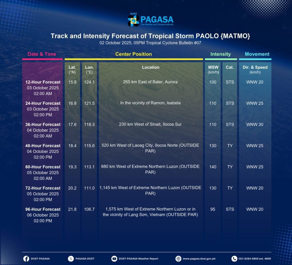
- Paolo* may make landfall over southern Isabela or northern Aurora by tomorrow morning (October 3, 2025).
- A southward shift in track remains possible.
- The storm is forecast to cross Northern Luzon, exit into the West Philippine Sea by tomorrow afternoon, and leave the Philippine Area of Responsibility (PAR) by Saturday morning (October 4, 2025).
- Further intensification into a severe tropical storm is likely before landfall, and a typhoon once it emerges over the West Philippine Sea.
📌 The public and local governments are urged to prepare for heavy rainfall, strong winds, and possible storm surges. Residents in high-risk areas are advised to follow evacuation orders and official advisories.
Next bulletin: 8:00 PM today.