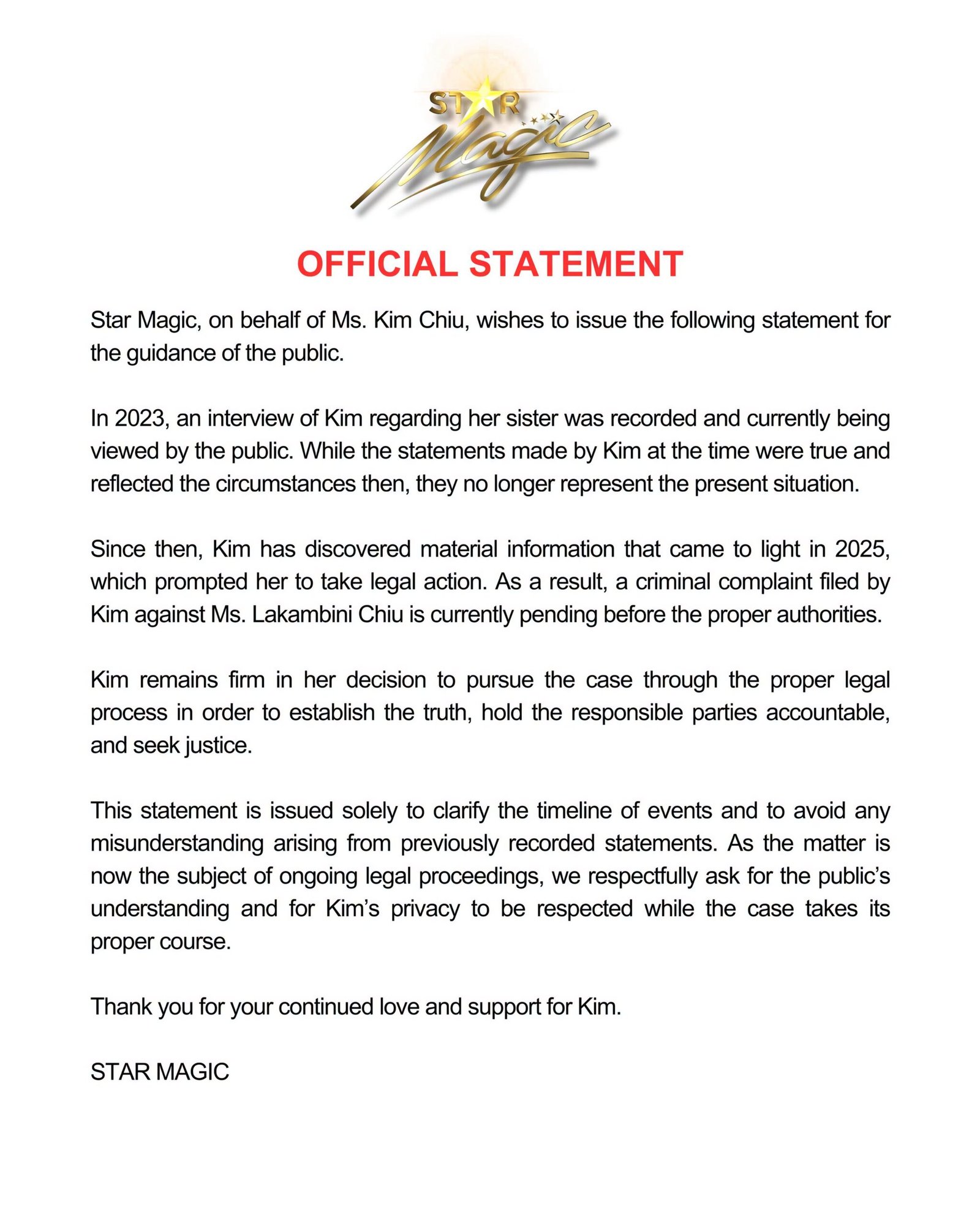

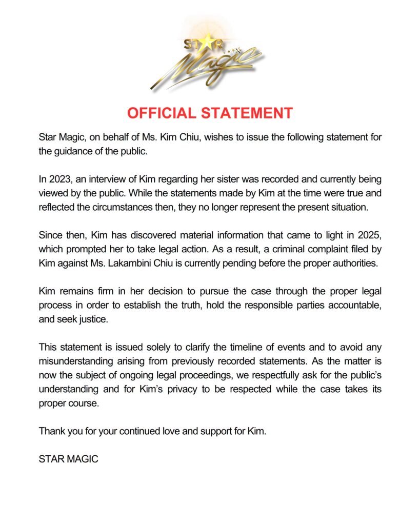


Typhoon Francisco (international name Mekkhala) is expected to intensify into a super typhoon within the next 12 hours, according to the Philippine Atmospheric, Geophysical and Astronomical Services Administration (PAGASA).
In its 5 p.m. bulletin on Monday, PAGASA reported that Francisco had strengthened further, with maximum sustained winds of 175 kilometers per hour near the center and gusts reaching up to 215 kph. The typhoon was last located 625 kilometers east of Tuguegarao City, Cagayan, moving west-northwestward at 20 kph.
Tropical Cyclone Wind Signal No. 1 remains in effect over Batanes and the northeastern portion of Cagayan, including Gonzaga, Santa Ana, and the eastern section of the Babuyan Islands.
PAGASA said the highest wind signal likely to be raised during the cyclone’s passage is Signal No. 2.
The typhoon’s outer circulation, combined with the southwest monsoon or habagat, continues to bring heavy rains over Batanes and Cagayan, as well as strong to gale-force winds across much of Luzon and the Visayas, and parts of Mindanao.
Rough sea conditions are also expected over the seaboards of Batanes, Babuyan Islands, mainland Cagayan, and the eastern coasts of Isabela and northern Aurora. Small seacraft operators, including motorbanca owners, were advised against venturing out to sea.
Despite its intensification, PAGASA said Francisco is forecast to remain far from the Philippine landmass and is expected to begin weakening by Wednesday.